
Wilson Neighbors by Public Record
The public trail around a Wilson address is divided by purpose. County GIS is best for seeing parcel boundaries, address points, roads, and nearby lots. The wEdge tax card gives owner, mailing, physical-address, value, sale, and property details for a selected parcel. The Register of Deeds supplies the recorded transfer and legal description. Community pages identify public groups, not membership lists. Treat these as separate tools, and do not assume a map label proves that a person occupies a building.
| Source | What It Shows Around an Address | Access |
|---|---|---|
| Wilson County GIS | Parcel shapes, address points, roads, districts, aerials, and tax fields | Public map with Identify |
| Wilson wEdge | Owner, mailing and situs addresses, values, sales, and property characteristics | Public address, parcel, or owner search |
| Wilson Register of Deeds | Grantor, grantee, legal description, book/page, and deed image | Guest index and office records |
| NC voter records | Public registration fields, precinct, status, and history after redactions | State search and downloads |
| City community pages | Public association names and city contact route | No public member roster located |
| Historic directories | Earlier household, business, and street-guide context | Library and DigitalNC collections |
Ownership and occupancy are different facts. A tax card can show an owner-of-record and a taxpayer mailing address, while the physical or situs address identifies the parcel. A deed shows a transfer, not an everyday household arrangement. For a full named-street record chain rather than the immediate block, use the Wilson streets directory after identifying the relevant parcels.
Map Wilson Neighbors Parcel by Parcel
The verified county method is map browsing, clicking, and Identify. In the Wilson County GIS map, Address or Street Search uses address points, while ownership and tax information comes from Identify on the Tax Parcels layer. Search one box at a time. A single match zooms to the point; multiple matches appear in the Results tab. Turn on parcels, streets, address points, Photography, and district layers only after the target result is clear.
- Enter the full target address in Address or Street Search and select the matching point or result.
- Use Identify on the target parcel. Record its GISPIN or parcel number, legal description, physical and taxpayer-address fields, and deed or sale references.
- Click parcels that share a boundary and the parcels across the street. Save parcel number and legal description before recording a name.
- Cross-check each selected parcel in wEdge, where physical address, owner, taxpayer mailing address, sales, and property fields can be compared.
- Use the Register of Deeds index when the book/page, legal description, or transfer history needs confirmation in the instrument image.
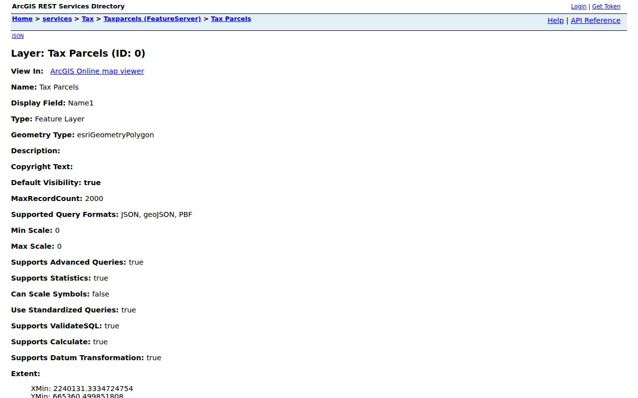
The Wilson GIS tax-parcel layer supplies the parcel and ownership-related fields behind this Identify workflow.
The GIS Download tab also offers Addresses, Tax Parcels, and Streets. The research did not identify a verified buffer or radius search, so do not claim that the map has a formal neighbor-radius tool. County and city maps are informational, not survey-quality; recorded deed instruments remain the source for legal title.
Wilson Neighbors Across a Street
A nearby polygon may be vacant land, a commercial or institutional parcel, common space, or land in another jurisdiction. It may also hold more than one unit or no dwelling at all. The map’s parcel shape is therefore a useful relationship clue, not a roster. Use the tax card to distinguish physical location from the taxpayer mailing address. A mailing address might be a post office box, corporate office, management address, or address outside Wilson.
Legal descriptions help when neighboring parcels share a subdivision, lot, block, plat book/page, or older tract reference. The GIS layer can expose parcel number, prior parcel number, map and block components, deed book/page, sale date, acreage, land use, and physical street parts. Compare those details before combining map results with a deed search. Parcel splits and merges can break a simple street-number trail, so an older lot or plat description can be more stable than the current address.
Note: A public parcel boundary identifies land for assessment and mapping purposes, not a promise that every nearby person appears in an accessible record.
Wilson Neighbors and Voter Records
The state name lookup cannot search for every person on a block. It requires a first and last name, with optional middle initial, year of birth, and county filters, plus at least one status selection. Current and historical voter files can be downloaded by county and filtered by precinct or status under state instructions, but a targeted public list is not the right use of those files. Precinct and district statistics provide block context without treating the voter system as a doorstep directory.
North Carolina makes much voter-registration information public under N.C.G.S. § 163-82.10 and Chapter 132, but the public split matters. Full birth dates, Social Security information, driver-license numbers, agency identity, military or overseas email, and protected addresses are withheld. Voter participation history shows elections associated with a record, never ballot choices. A protected voter’s substitute address should not be traced back through other public materials.
| Official public records | Identify specific parcels, owners of record, registration facts, and recorded transfers with source limits and update dates. |
|---|---|
| Commercial people-search products | May blend marketing data, directories, and probabilistic matches; duplicates and stale entries can occur. |
| Best use | Confirm a public fact with the custodian and avoid treating either category as a complete list of people around an address. |
Wilson Neighborhood Association Contacts
The City of Wilson’s Neighborhood Associations page lists public group names and directs residents to Human Relations at 252-399-2308. It does not provide association member lists. That distinction matters: a civic group can give a block its shared name or a public meeting route without confirming who belongs to the group or who lives at a particular parcel.
| Publicly Listed Group | City Contact or Meeting Detail | Record Boundary |
|---|---|---|
| Adventura East; Downing Cares; Freeman Place | Human Relations route | No public roster located |
| Cranberry Ridge, Landfall, Millbrook, and Walker’s Trace | Human Relations route | Group name is not parcel ownership |
| Daniel Hill | Second Monday at 6 p.m. | Meeting detail is not a member list |
| Washington Carver Heights | Second Monday after the first Sunday at 7 p.m., South District Police Station | Verify current meeting information with the city |
| Valleydale Estates and Glenwood Hills | Phone-conference contact noted by the city | City page does not establish membership |
The city page also marked Elvie and Five Points inactive at the time the research was gathered. That status can change, so use Human Relations for current confirmation rather than copying a past meeting detail. The city provides a how-to kit for forming an association, another sign that an association name is a civic route, not a public member register.
Private association, congregation, block-watch, and civic-club membership lists were not located in official public sources. Ask Human Relations for the correct public leader-contact route, rather than inferring membership from a tax neighborhood or a map label.
Note: A community name supplies context for a block, but it does not identify the people connected with every parcel.
Wilson Neighborhood District Context
The city’s police-district page offers another community layer. Central includes Daniel Hill, The Venue, and Old Wilson. North includes Eyes on Cavalier, Airport Corridor, Grove Street, Crescent Gardens, Heritage, and The Watch. South includes Glenwood Hills, Washington Carver Heights, Elvie Street, Beacon Point, and Bel Air. West includes Forest Hills Manor, Five Points, and Walker Trace. The city says GIS can identify the police district for an address.
Police district names, city neighborhood names, and tax-neighborhood codes are not interchangeable. In historic Wilson, the Old Wilson local district contains roughly 361 properties and includes Maplewood, Woodard Circle, Whitehead Place, College Place, and Rountree Place. Those names can guide a map or newspaper search, but a named area is not proof of ownership, membership, or current presence at any parcel.
Wilson Neighbors in Older Directories
Historical block work uses a different source set. DigitalNC has verified Wilson city-directory volumes for 1908–09, 1912–13, 1916–17, 1922–23, 1925, 1930, 1941, 1947–48, 1950, and 1959. The local library also holds newspaper, obituary, and local-history resources. A street guide can place a household or business at an address in that volume’s year, but omission does not prove that the address was empty or that no one lived nearby.
The 1930 Wilson abbreviation key adds useful context to an old street entry. It defines R D as rural delivery, cor as corner, bet as between, P O as post office, wks as works, and wid as widow. These shorthand marks can explain why a modern exact-name or exact-address search misses an otherwise useful reference.
Telephone directories are a separate subscriber record. The research verified Wilson volumes for 1936, Fall 1937, and 1938. Pair an old street-guide entry with deed legal descriptions, maps, census geography, and obituaries before drawing a household conclusion. The Wilson city directory collections provide the historical reading method and abbreviation context. This is an earlier-address trail, not a modern neighborhood roster.
Note: Record the directory year and page because an older address entry has a limited time and source context.
Limits on Wilson Neighbor Lookup
North Carolina Public Records Law covers existing public records, not a command that Wilson staff create a new people list. Utility account holders, shutoff addresses, sanitation customer information, and public-enterprise billing data are protected under the city’s stated rules. DMV personal information is not an ordinary public route. Protected voter addresses and sensitive identifiers are excluded from voter materials. Sealed, juvenile, expunged, adoption, and investigative records also follow separate limits.
A public record may be old, incomplete, or about a different person with the same name. Do not use a map, address, or public record to contact, monitor, threaten, or expose another person. If a tax, voter, or deed entry is inaccurate, seek correction from the Tax Department, Board of Elections, or Register of Deeds using the parcel, NCID, or book/page reference. For a suspicious deed-copy notice, verify it through the Register of Deeds rather than the contact information on a mailer.
Lawful use. Use Wilson neighbor information for personal property curiosity, community context, family history, and civic awareness. Public records are never permission to stalk, harass, intimidate, or harm anyone.