
Wilson ZIP Code Coverage and Routes
Official USPS material identifies a Wilson ZIP family of 27893, 27894, 27895, and 27896. It does not publish a neighborhood-by-neighborhood municipal boundary table for those labels. The safe use of a Wilson ZIP code directory is therefore to distinguish Wilson postal geography from an area that still needs an address-specific check. The USPS response for the actual Wilson street address is the delivery answer.
Wilson Main, Woodard, and Parkwood are the local retail or service locations surfaced in the research. A station address does not establish the delivery boundary for every nearby Wilson street. Likewise, 27894 and 27895 appear in the Wilson family, but the research did not confirm a separate retail station or a complete delivery polygon for each one.
| ZIP | Wilson relationship | Post office or station | Record-use note |
|---|---|---|---|
| 27893 | Primary Wilson ZIP for central Wilson and other Wilson delivery addresses | Wilson Main, 501 Mercer St SW | Exact neighborhood boundary was not located; verify the street address with USPS. |
| 27894 | Wilson postal and PO or mailing variants | Wilson delivery relationship identified; separate retail station not confirmed | Do not assume every 27894 address is within a city parcel. |
| 27895 | Part of the local Wilson ZIP family | Separate retail office not located in the inspected sources | Use the USPS address lookup rather than a neighborhood assumption. |
| 27896 | Wilson delivery label used for city and outer addresses | Woodard and Parkwood are listed alternate Wilson locations | Postal Bulletin material records a label change; confirm each delivery address. |
Postal labels are useful search keys, but they do not create a city directory of every household. Preserve directional street parts such as NE, NW, SE, and SW when checking an address, since leaving out a direction or street type can return a different location.
USPS's Wilson Main Post Office record supplies the verified location context for the primary Wilson ZIP.
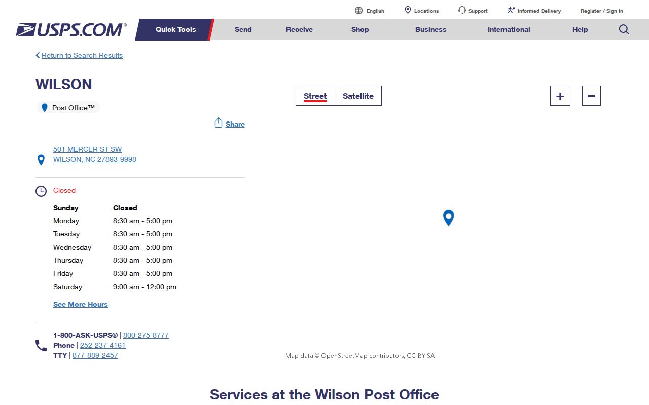
The location record identifies the Main Post Office and its services, while the address lookup remains necessary to check a particular delivery address or ZIP+4 result.
Wilson ZIP Code Verification at USPS
The official USPS address lookup is the delivery check for one Wilson address. Enter the complete address as USPS recognizes it, including directional prefixes or suffixes, street type, unit information when applicable, and the city and state. A postal response may supply a ZIP+4 or a formatting correction. Treat that result as a current mail-delivery answer, not a statement about city limits, ownership, or who occupies the address.
| Lookup input | What it tests | Why it matters in Wilson |
|---|---|---|
| Street address | Address-specific delivery label | ZIP boundaries follow routes and can cross municipal lines. |
| Unit or apartment | Delivery detail within a larger address | Leaving out a unit can produce an incomplete postal answer. |
| City and state | Postal locality context | A Wilson mailing label alone does not prove city-limit status. |
| ZIP+4 result | More specific routing detail | It should be retained as a mailing detail, not used as a parcel identifier. |
USPS lists Wilson Main Post Office at 501 Mercer St SW, Wilson, NC 27893-9998, with its own location details. Retail-location information and a route boundary are different records, which is why address verification remains necessary.
The USPS address lookup is available through this official postal search route.
The form is the appropriate final check after a map, tax card, or historic directory supplies an address, because the postal label can change by delivery route.
Wilson ZIP Code Label Change in 2018
A 2018 USPS Postal Bulletin change maps the Wilson labels 27894, 27895, and 27896 from Wilson 27893 to Wilson 27896 for label-container purposes. It is a real postal processing and labeling detail. It is not evidence that every street changed postal label, that one city boundary moved, or that a historical parcel should be assigned a new physical location.
That distinction matters when Wilson records disagree. A deed uses a legal description or parcel references, a tax card can separate a physical address from taxpayer mail, and a city directory may predate ZIP coding altogether. Keep the record's date and purpose with its address instead of rewriting it to fit a present postal label.
The Postal Bulletin notice documents the Wilson label realignment.
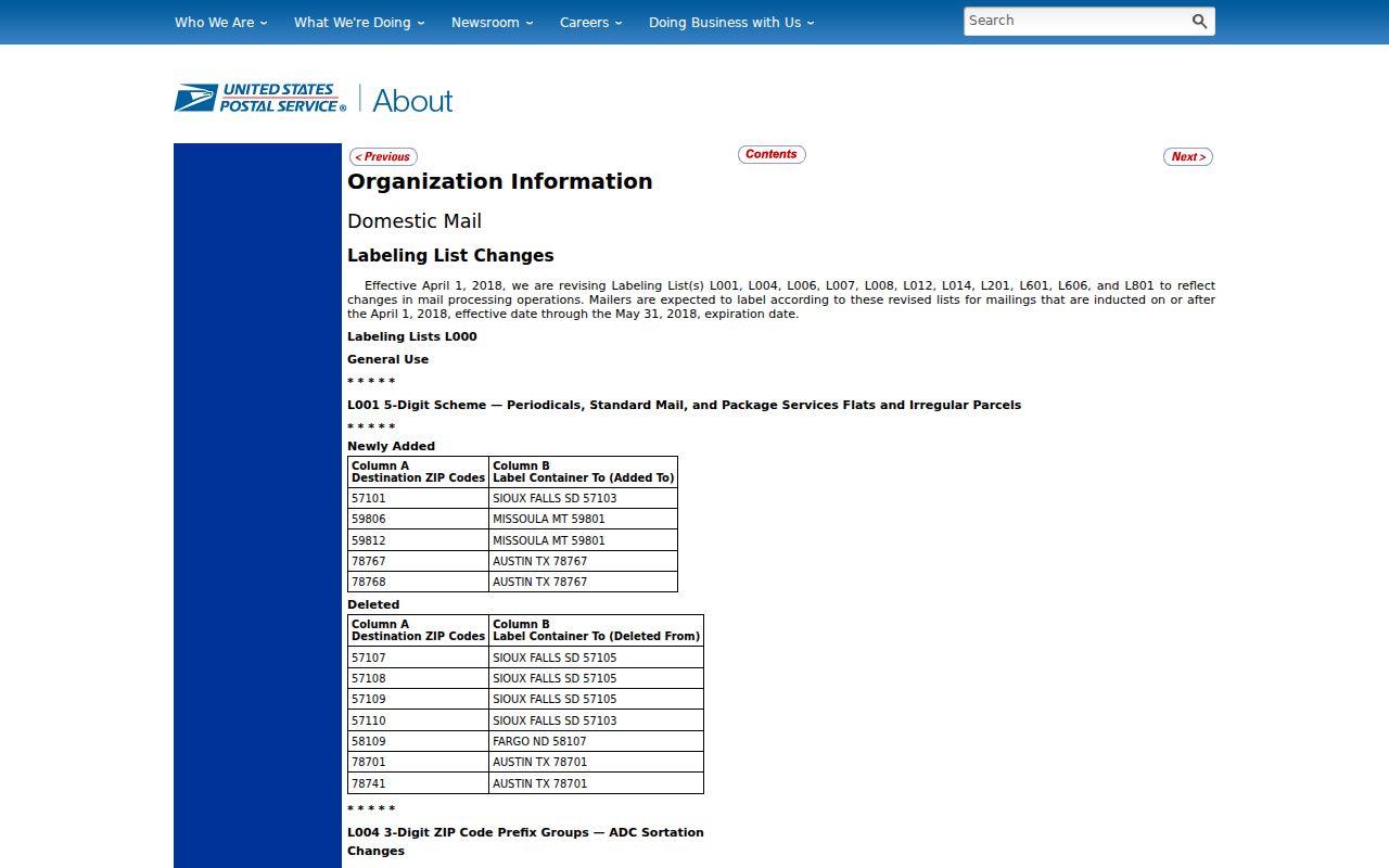
The dated notice is best read as a mailing-system clue. For an active delivery address, return to the current USPS lookup rather than extending the bulletin beyond its stated purpose.
Find Wilson Residents by ZIP Code
No inspected Wilson property or voter interface offers a universal public resident search by ZIP. The county wEdge property search accepts Property Number, Owner Name, or Address, and its advanced form has value, acreage, sale, municipality, neighborhood, class, and tax-year controls but no visible ZIP field. The state voter lookup filters by county and status, not ZIP. Use a ZIP to verify an address, then move to the record type that fits the question.
- Verify the exact delivery address in the USPS lookup and save the formatting and ZIP result.
- Search the address in Wilson County wEdge for the parcel's owner-of-record, physical address, tax references, and mailing details.
- Use the Wilson County GIS user guide process: search the address point, then use Identify on the Tax Parcels layer for ownership data.
- If election geography is relevant, use the North Carolina voter lookup by name, county, year, and status rather than assuming a ZIP boundary equals a precinct.
- Compare the physical address, taxpayer mailing address, city or district field, and postal result before treating two records as the same location.
Once a ZIP has narrowed the area, the Wilson street directory follows the address, parcel, deed, and map sequence in more detail. A property owner is not automatically the current resident, and a taxpayer mailing address is not proof that its recipient lives at the parcel.
Wilson ZIP Code Fields in Parcel Data
Wilson County GIS separates address components instead of treating an address as one simple label. Its tax-parcel service exposes physical street number, directions, street name, type, unit, TaxpayerAddress fields, TaxpayerCity, ZIPCode, city and district fields, parcel numbers, deed references, and geometry. The information can support a careful comparison, but a field called ZIPCode may describe a taxpayer mailing address rather than the parcel's situs address.
Start with the current Wilson physical location and then read the mailing fields as a separate contact route. The Wilson County GIS service provides maps, aerial imagery, streets, parcels, and layers. Its guide says to use one search box at a time. Address search uses address points, while owner and tax information comes from Identify on the parcel layer.
The city warns that GIS maps are informational rather than legal surveys. A recorded deed or plat remains the source for legal title and boundary evidence.
Wilson ZIP Code Boundaries and City Limits
A Wilson mailing city can appear on an address outside incorporated Wilson, while a parcel inside a city service area can carry a different mailing label. Postal delivery routes, county GIS jurisdiction layers, tax-card fields, and municipal boundary maps do not all answer the same question. Use the county or city layer for jurisdiction, USPS for the delivery label, and the tax or deed record for property identity.
The mismatch is especially important for historical research. Older Wilson city directories may show an address before ZIP coding, while a modern tax card can show both a situs address and taxpayer mailing address. Do not force the old address into a current ZIP until a street guide, plat, legal description, map, or USPS result supports the link.
- Postal ZIP
- A postal delivery designation for an address or mailing route. It is not a municipal-boundary label.
- ZIP+4
- An added postal routing detail associated with a more specific delivery segment. It does not replace a parcel number.
- PO-box ZIP
- A postal designation used for box or mailing service. It should not be assumed to describe a physical residence.
- Carrier route
- A postal delivery grouping used to move mail. It can cross the kinds of jurisdictional boundaries used by property records.
Note: USPS delivery geography is not a complete resident roster, and public address data should be used only for lawful personal research and never to harass or harm anyone.
Wilson ZIP Code and Voter Geography
North Carolina's voter lookup is county-based, not ZIP-based. Its visible form requires first and last name and a status selection, with optional middle initial, year of birth, and county. Matching a person by ZIP alone is not an option. County files and historical snapshots may contain public address and precinct fields, but protected addresses and other confidential details are withheld.
Use precinct and county as election-record geography. The state's voter-registration data offers current and more than 15 years of snapshots, while participation history is maintained separately and does not reveal ballot choices. When a record is protected or absent, do not try to reconstruct a private address from postal, parcel, or neighborhood clues.
The Wilson County Board of Elections provides local assistance at 112 Douglas St East, while the state lookup remains the public starting point. The county also notes that polling locations can change, so current lookup results are safer than an old address list.
Wilson ZIP Code Limits for Older Addresses
ZIP coding is a recent layer over a much older Wilson address history. When an address from an old directory, newspaper, deed, or Sanborn map will not resolve, search the street guide, subdivision lot or block, legal description, adjoining properties, and prior parcel number. The official research did not locate a confirmed citywide Wilson street-renumbering date, so an apparent mismatch should be investigated rather than assigned an invented conversion year.
The 1884 Wilson Sanborn map is verified through the Library of Congress; it can show building footprint, street name, use, and lot context but not a complete household list. Digital city directories, deeds, and tax/GIS references can then bridge historic wording to a modern postal lookup. Each source contributes a different part of the address history.
Note: A correct ZIP result confirms mail delivery for the queried address, not ownership, residence, city jurisdiction, or the identity of a person connected to another record.