
Search a Wilson Street by Address
Wilson addresses often carry a direction and street suffix, and the county GIS keeps those parts separately. Enter the full address in Wilson County GIS under Address or Street Search. That search finds an address point. It does not itself establish ownership. Use Identify on the Tax Parcels layer to collect the GISPIN or parcel number, the parcel shape, physical location, district, nearby streets, and legal-description references. The county guide recommends using one search box at a time, then selecting a result from the Results tab.
- Search the full Wilson street address in GIS and save the parcel number or GISPIN. Turn on parcels, streets, and Photography when map context helps.
- Run that parcel number in wEdge. Compare the physical address, owner of record, taxpayer mailing address, legal description, prior sale reference, and tax year.
- Open the cited book and page in the Register of Deeds guest index. Read the image for the legal description, parties, instrument type, and recording details.
- Use the North Carolina voter lookup only to check an individual registration and jurisdiction. It has no public all-voters-on-a-street screen.
- For older household context, compare the street guide and alphabetical pages in the Wilson city directory collections, then test the address against deeds and maps.
Note: A parcel key ties the map, tax card, and deed together more reliably than a street name alone.
Wilson GIS Street Search Tools
The county GIS viewer separates Parcel Search from Address or Street Search. An address result comes from address points, while ownership and tax facts come from Identify on the parcel layer. Search results can be selected to zoom, and the Results List returns to several matches. Layers can add roads, parcels, address points, topography, public districts, and aerial or historical photography. The Download tab links to Addresses, Tax Parcels, Streets, and county open data. Maps are useful discovery tools, not survey-quality evidence.
| Wilson GIS control | Street-directory use |
|---|---|
| Address or Street Search | Finds an address point or street result, with one search box used at a time. |
| Parcel Search | Finds records in the Tax Parcels layer when a parcel identifier is known. |
| Results tab and Identify | Zooms a match and exposes parcel attributes needed for a tax-card check. |
| Layers and Photography | Adds parcel, street, aerial, and thematic context to a Wilson street search. |
| Download | Offers Addresses, Tax Parcels, Streets, and GIS Open Data links. |
Parcel geometry can show that two addresses are nearby. It cannot establish a legal boundary or the people connected to a building. Confirm title in a recorded instrument and assessment details on the tax card.
Wilson Tax Cards Along a Street
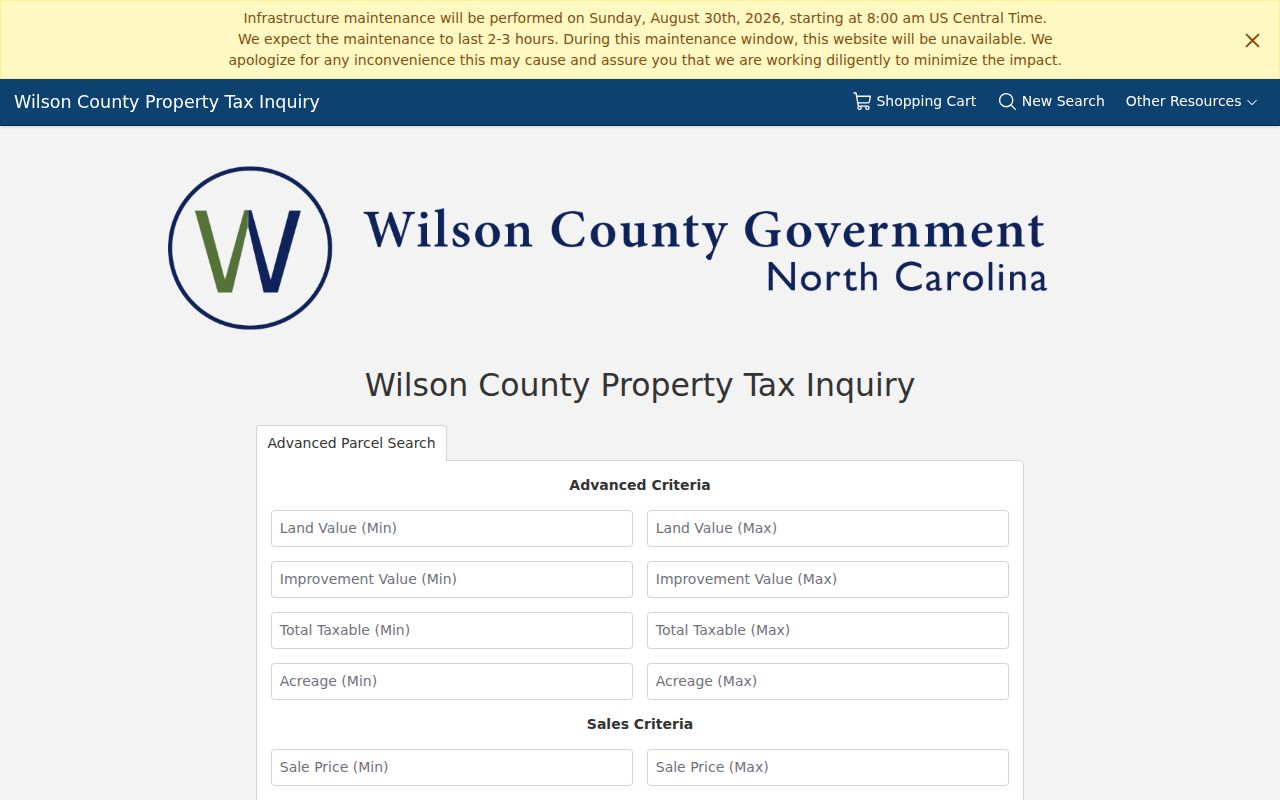
The Wilson wEdge advanced parcel form offers land-value, improvement-value, total-taxable, acreage, sale-price, sale-date, property-class, municipality, neighborhood, and tax-year controls. Search All Tax Years is available, but the inspected form does not state its full historic range. It also has no ZIP filter. For a street-directory task, use the full address or parcel number first, then open the selected real-estate card instead of treating value filters as a people search.
| Field or control | Type | Required? | Street use |
|---|---|---|---|
| Property Number, Owner Name, or Address | Text | One value expected | Starts an address, owner, or parcel search. |
| Advanced Search | Link or button | Optional | Opens the parcel filters. |
| Land Value Min/Max | Numeric text | Optional | Locates parcels by assessed land value. |
| Improvement Value Min/Max | Numeric text | Optional | Isolates improved parcels. |
| Total Taxable Min/Max | Numeric text | Optional | Applies a value band, not a person filter. |
| Acreage Min/Max | Numeric text | Optional | Compares lot size along a street. |
| Sale Price and Sale Date Min/Max | Range and MM/DD/YYYY date text | Optional | Finds transactions that still need deed-image review. |
| Property Classes and Summaries | Dropdowns | Optional | Narrows assessment class. |
| Municipalities and Neighborhoods | Dropdowns | Optional | Narrows assessment geography, not a civic-group or occupant list. |
| Search All Tax Years | Checkbox | Optional | Includes available years without a stated complete range. |
| Tax Year Low/High | Numeric or select | Optional | Selects the available historic tax range. |
| Payment Status and Hide Retired | Result controls | Optional | Refines returned records; it is not occupancy evidence. |
| Sort and Export Results to CSV | Select, checkbox, and button | Optional | Reorders or saves a returned list where exposed. |
Wilson’s advanced wEdge search is shown below, with the parcel filters available for address research.
A returned card can list the owner, physical or situs address, taxpayer mailing address, legal description, acreage, plat reference, sales history, values, and permit-date notes. The mailing address shows where tax notices go. It is not proof that the owner is present at the parcel.
- Parcel
- A mapped land record with a county identifier. It can link GIS, wEdge, and a deed reference.
- Situs address
- The physical location of the parcel or building, distinct from the address used for tax notices.
- Plat
- A recorded map that can show a lot, block, subdivision, and book or page reference.
- Street guide
- The address-ordered portion of a historical directory, used with its alphabetical pages.
Wilson Street Directory Record Sets
Address-keyed records in Wilson County have different limits. The tax card names an owner of record and can point to a prior sale. GIS supplies the parcel relationship. The Register of Deeds supplies recorded parties and legal descriptions. City and county permit routes can document a public construction, correction, or certificate event. Historical directories offer an older address clue. A name from one source should be compared with at least one other record before it is treated as the same person or property.
| Wilson street record | Custodian | What it can show | Access route |
|---|---|---|---|
| Tax parcel card | Wilson County Tax Department | Owner, mailing and situs addresses, value, sale, and legal fields | Free wEdge search |
| GIS tax parcel | Wilson County GIS | Parcel shape, PIN, deed references, map layers, and attributes | Public map and REST layer |
| Land instrument | Wilson County Register of Deeds | Grantor, grantee, date, book/page, amount, and image | Guest index, counter, books, or microfilm |
| Election record | NC State Board of Elections | Individual registration status and jurisdiction, subject to redactions | State lookup or existing county file |
| Permit or inspection | City or county offices | Public permit, inspection, correction, or certificate clues | Portal, office, or focused request |
The parcel number is the best handoff between these systems. A recorded plat or legal description is especially useful if a simple address search fails after a split, merge, changed number, or old street notation.
Wilson Street Deed Index Quirk
The Register of Deeds says its online real-estate indexes begin in 1974. The guest portal also displays a 1946 through 1973 date-range notice. Older results can show January 1 placeholder dates, so the image is needed to confirm the actual recording date. Search parcel, name/index, book/page, file date, instrument kind, grantor, grantee, description, file number, reference, or amount after guest entry. When an online image fails or the chain goes earlier, use the office counter, deed books, microfilm, the library, or North Carolina Archives county records.
The Wilson Register of Deeds guest portal is pictured below. Its book/page route connects a tax-card reference to the recorded transaction.
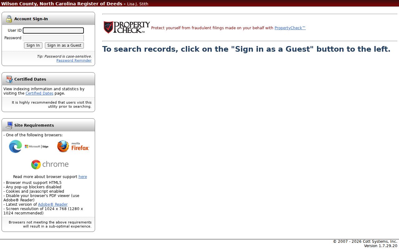
A deed image can confirm the instrument, grantor, grantee, amount, legal description, and prior reference. It records a land transaction, not a list of everyone at a street address.
Wilson Street Addresses and ZIP Labels
Wilson mailing labels use the 27893 through 27896 ZIP family, but a ZIP is delivery geography rather than a city-limit line. The county GIS can show city-code and jurisdiction fields, while a tax card can separately show a taxpayer mailing ZIP and a physical location. The official USPS result for the exact address is the delivery check. wEdge does not expose a ZIP field in the inspected advanced form, and the deed index relies on parties, parcel, address, book/page, or legal description instead.
The Postal Bulletin records a 2018 label-container realignment involving Wilson ZIP labels. It was not a declaration that every street changed ZIP. Preserve street directions such as NE, NW, SE, and SW during a search, then verify a delivery address with the USPS ZIP Code Lookup.
Wilson Voter Records by Street
North Carolina’s voter lookup requires first and last name. A middle initial, year of birth, and county are optional, and at least one status choice is required: Registered, Removed, or Denied. It can return voting jurisdictions, polling-place information, a sample ballot when available, absentee information, and voter history. It is not a public street roster. County voter files and historical snapshots are available through the state, but requests should seek an existing file by county, precinct, status, or date range rather than a new compilation.
Most registration information is public under N.C.G.S. § 163-82.10 and Chapter 132. Full dates of birth, Social Security numbers, driver-license numbers, agency information, military or overseas email, and protected addresses are withheld. A protected address must not be inferred from another public source.
Wilson Street Permits and Requests
Address-specific permit and code records can explain construction, alterations, corrections, certificates, or public project work. The city routes permits through its Wilson Application Portal; the county Inspections Division routes electronic permits through OpenGov. The inspected sources did not provide a complete public historical search-field list for either archive. When a portal has no useful result, ask for an existing public permit, certificate, plan, or code record by exact address and time period.
The city public-records request route asks for names, dates, time period, keywords, and desired email scope. County Inspections also accepts online and in-person permit submissions, but the historical search range was not stated. Focused requests are more likely to match records already held by the office.
Note: Permit dates can place a physical change in time, but they do not identify all people tied to an address.
Wilson Street Directory History Clues
The 1950 Hill volume describes an alphabetical name department and a householder street or avenue guide. That division matters for a Wilson street-directory search. A street-page address can be the lead, while the alphabetical entry can add the printed name or a business connection. Read both pages from the same volume.
For a past Wilson street address, use the historical street guide with the matching alphabetical directory pages. DigitalNC verifies local Hill Directory Company volumes for 1908-09, 1912-13, 1916-17, 1922-23, 1925, 1930, 1941, 1947-48, 1950, and 1959. A missing entry is not proof that a person was absent. The name might appear under an initial, spouse, business, or a different spelling. The 1930 abbreviation key also turns forms such as R D, cor, bet, and wid into useful reading clues.
The Wilson County Public Library Local History Room can be contacted for city directories, reverse or criss-cross volumes, telephone directories, newspaper microfilm, obituaries, yearbooks, cemetery material, and neighborhood histories. The official library page does not confirm a complete shelf list, so ask for the specific year and format needed. Historical numbering should be bridged with the street guide, maps, adjacent streets, plat, parcel geometry, and legal description. No confirmed citywide Wilson renumbering year was located in the official sources.
Wilson Street Directory Limits
A Wilson street directory assembled from public records remains incomplete. Maps show parcels, not full households. Tax cards identify an owner of record, not every person using a building. Deeds record transactions. Historical directories can omit people or use older street notation. Utility customer data is protected under N.C.G.S. § 132-1.14, and motor-vehicle address data is restricted by the federal Driver’s Privacy Protection Act. A blank result does not prove that no person has a connection to the address.
Lawful use. Use Wilson street records for family history, property history, civic questions, or personal curiosity. Do not use address information to stalk, harass, intimidate, or harm another person.