
Wilson Previous Residents by Era
One Wilson address can produce several trails, not one complete historical roll. Begin with the current parcel card because it can supply the owner of record, physical and mailing addresses, legal description, and a prior deed reference. The Register of Deeds then identifies parties to recorded instruments. Street guides and telephone books can put a historical name at an address, while census schedules add household relationships and ages. Maps explain the building or street setting. Probate, obituaries, and estate files can explain why a name stops appearing.
| Address-history source | Wilson era or coverage | Where held | What it adds |
|---|---|---|---|
| wEdge tax card | Current card; sample sale history reaches 1983 | Wilson County Tax Department | Current owner, mailing and situs addresses, values, and sale references |
| ROD online index | County headline since 1974; portal displays 1946-73 with caveats | Wilson ROD guest portal | Recorded parties, book/page, legal description, amount, and images |
| Books, microfilm, and archives | Earlier county material; exact book-by-book cutoff not located | ROD counter, library, and NC Archives | Older deeds, plats, liens, and instruments |
| Wilson city directories | Verified digitized volumes from 1908-09 through 1959, with gaps | DigitalNC and Local History Room | Alphabetical and street-guide address context |
| Telephone directories | 1936, Fall 1937, and 1938 Wilson listings | DigitalNC | Subscriber or business phone and address clues |
| Federal census | Released 1850-1950 schedules | Archives and authorized library databases | Household relationships, ages, and enumerator geography |
| Permits and inspections | Online historical range not located | City and county permit routes | Construction, alteration, correction, and certificate clues |
| Sanborn and estate material | Wilson December 1884 map confirmed; dates vary for estates | Library of Congress, Clerk, library, and Archives | Building context, heirs, property, and family leads |
If the question is ownership, start with wEdge and the deed index. If the question is who lived here before, test a street-guide entry against the closest released census schedule and other independent details. A missing item does not prove the address or person disappeared.
Wilson’s 1946-1974 Index Boundary
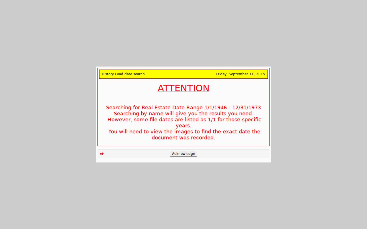
The Wilson County Register of Deeds says online real-estate indexes begin in 1974. Its guest portal also displays a 1946 through 1973 search range. That overlap is useful, but it is not proof of complete online coverage before 1974. Older results can carry January 1 placeholder dates, and the image must be read to confirm the exact recording date. This is a Wilson-specific index quirk that matters when tracing past residents through an address rather than assuming a date filter tells the full story.
For a document outside the dependable online route, continue at the Register of Deeds counter, then use deed books, microfilm, the North Carolina Archives county-record collections, and the library. Wilson County was formed in 1855 from Edgecombe, Nash, Johnston, and Wayne. A property or family trail before that date may belong in one of those parent counties. No confirmed courthouse-loss event was found, so an online gap should not be described as a destroyed record.
Index caution. Treat the 1946-73 portal display as a lead, then confirm its date and legal text in the deed image or book.
Wilson Previous Residents and Deed Chains
The backward property trail begins with a current address or parcel in Wilson wEdge. Save the parcel number, owner, physical address, taxpayer mailing address, legal description, plat reference, sale date, book/page, and prior parcel number if it appears. The physical address locates the parcel. The mailing address shows where tax notices go and may be an office, agent, PO box, or address elsewhere. The legal description is the better identity check when street numbers change or several parcels have similar addresses.
- Open the latest deed referenced by the tax card in the Wilson Register of Deeds guest index. Record the instrument type, filed date, grantor, grantee, book/page, amount, parcel, and image count.
- Read the deed image. Compare its lot, block, subdivision, metes-and-bounds wording, prior reference, and actual recording date with the parcel card.
- Take the seller, called the grantor, and search that party as a grantee in the earlier period. A chain alternates the current grantee, the prior seller, and that seller’s own acquisition.
- Narrow same-name results by legal description, subdivision, lot or block, street, parcel, book/page, and approximate date. Try punctuation and suffix variants for entity names.
- When the online trail becomes uncertain or earlier, move to books, microfilm, the counter, the library, or Archives material. Preserve the book/page reference for every link.
- Grantor and grantee
- The grantor transfers an interest in land. The grantee receives that interest in the recorded instrument.
- Chain of title
- A sequence of recorded transfers for the same land, checked through parties and the legal description.
- Legal description
- The lot, block, subdivision, tract, map reference, or metes-and-bounds wording that identifies land beyond a mailing address.
- Prior parcel number
- An earlier county parcel key that can help when a split or merge breaks a simple address search.
Wilson Book Pages for Past Residents
A book/page result supplies a strong bridge from a present parcel to an older instrument. The ROD result can display book, page, party mode, file date, instrument kind, grantor, grantee, description, file number, amount, reference, and image count. The image remains the authority for the full text. Read it before connecting a name to an address, especially where a company, trust, or similar name appears in several transactions.
This Wilson ROD book/page result shows the fields and image controls that support a careful earlier-owner search.
The result points to a 2022 deed for 2402 Wooten Boulevard and includes a legal-description bridge, amount, parties, and five images. Those details describe the recorded transaction. They should be paired with the matching parcel and image before being used in an address history.
Wilson Previous Residents in Directories
Wilson city directories are the household layer of the backward trail, not a replacement for deeds. Verified digitized Hill Directory Company volumes are available for 1908-09, 1912-13, 1916-17, 1922-23, 1925, 1930, 1941, 1947-48, 1950, and 1959. The 1950 publisher introduction describes alphabetical names, buyers guide, classified business, and a householder street or avenue guide. Use the street-guide page and alphabetical page together. The collections themselves are detailed in the Wilson city directory.
Not every volume prints every kind of detail. Entries can include a name, marital-status notation, occupation, business affiliation, street address, householder listing, telephone context, or a printed abbreviation. The 1930 key makes R D rural delivery, cor corner, bet between, P O post office, wid widow, and wks works. Exact spelling, page number, street direction, and an adjacent entry are worth recording. A telephone directory is a separate subscriber trail, not a complete household roll.
For Wilson previous residents, compare a printed address with a deed or parcel reference before carrying the name into another year. The same street can hold a business, a family address, or an abbreviated entry that needs a second source.
Note: A directory gap may reflect omission, a spouse or business listing, an unlisted phone, or a city-boundary difference.
Wilson Past Residents and Census
Pair a directory year with the nearest released federal census instead of treating either one as complete. The directory can supply an address, initials, occupation, or business clue. The census can add household relationships, ages, birthplace, and its own enumeration geography. Released schedules run through 1950 under the 72-year rule. Census street references can differ from modern numbering, so use them with the printed directory year, street guide, deed legal description, or a map.
- Start with the known address, deed reference, death notice, or current tax card and choose the closest directory before and after that event.
- Read both the alphabetical and street-guide pages. Save the exact spelling, initials, address format, marital notation, occupation, and any abbreviation.
- Pair the directory period with the nearest released census: 1900, 1910, 1920, 1930, 1940, or 1950 where it fits the question.
- Test at least two anchors before merging names, such as address plus spouse, middle initial plus occupation, or deed plus obituary.
- Use an obituary, probate file, deed, or vital record to explain a disappearance, surname change, inheritance, or later transfer.
An enumeration district is the geographic area assigned to a census taker. It helps place a household in time, but it is not a guarantee that the printed street number matches today’s address.
Wilson Past Residents on Sanborn Maps
The confirmed Library of Congress Wilson Sanborn map is a December 1884, one-sheet fire-insurance map. It can help date a building footprint, street name, use, material, lot context, or street relationship. It does not name every person connected to a structure. Later Wilson sheet years have been suggested by a local-map index, but those editions were not each confirmed in the official inspection. Search the Library of Congress collection before relying on any complete list.
Official sources did not identify a confirmed citywide Wilson renumbering year. When an old number fails in a modern map, bridge the record with the city-directory street guide, Sanborn map, subdivision or plat names, adjoining streets, railroad or creek landmarks, GIS parcel geometry, and the deed legal description. A structure shown in 1884 and a name first found in a later directory establish an interval, not a claim that the place had no earlier household.
Wilson Past Residents and Estate Files
Obituaries, probate files, and heir deeds can close a Wilson address trail. The Wilson County Public Library Local History Room offers appointment-based research, newspaper access, local exhibits, and databases including Ancestry Library Edition, Newspaper Archive, Fold3, Heritage Hub, and Wilson Times material. Ask for the exact year, street, name variation, and record type. The official library page does not prove that every reverse directory, cemetery record, or funeral-home register is available, so request the specific collection rather than assume it is on the shelf.
An obituary may identify relatives, former address, church, cemetery, or funeral home. Treat it as a lead and compare it with a recorded deed, public estate file, cemetery source, or second notice. The Wilson County Clerk of Superior Court holds estate and other court files, while the ROD can reveal a later deed to an heir. Public status and sealed material control what can be inspected.
Lawful use. Researching Wilson previous residents is for family history, house history, estate questions, and personal curiosity. Do not use a historical address trail to stalk, harass, track, or harm a living person.